


Farms is an Android app designed to enhance agricultural productivity by providing tools for satellite imagery monitoring, area measurement, and advanced weather forecasting. It simplifies day-to-day farming operations by combining modern technology with agriculture's age-old practices. The platform offers essential resources to support decision-making for rural producers in both online and offline scenarios, making it accessible and user-friendly.
High-Resolution Satellite Imagery
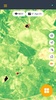
One of Farms' core features is its advanced satellite imagery, available through Super Maps. This function delivers high-resolution, full-screen maps with cutting-edge visual indicators such as vegetation indexes like NDVI, SAVI, and EVI, true-color images, and water stress data. With these tools, users can gain a comprehensive view of any farming area, improving crop monitoring and management.
Integrated Area Measurement Tools
Farms includes MultiPolygon tools that allow for precise area measurements, either for single or multiple sections of land. By creating integrated polygons, users can easily share details with various machinery, such as sprayers, seeders, and drones. To enhance compatibility, the app supports importing and exporting KML files and Shapefiles commonly used in advanced agricultural equipment and GPS systems.
Innovative Weather Forecast Visualization
The app also offers a unique weather forecasting system called CromoClimatic Prediction. By using a color-coded table to display meteorological and agronomic indicators, it provides an intuitive and organized approach to planning key activities like planting, fertilizing, and irrigation. Farms is a powerful tool that equips you with vital insights to optimize efficiency in managing your crops.
Requirements (Latest version)
- Android 7.0 or higher required
Comments
There are no opinions about Farms yet. Be the first! Comment